Mission summary
Total photos
419
With GPS coordinates
419 / 419
Flight duration
32.4 min
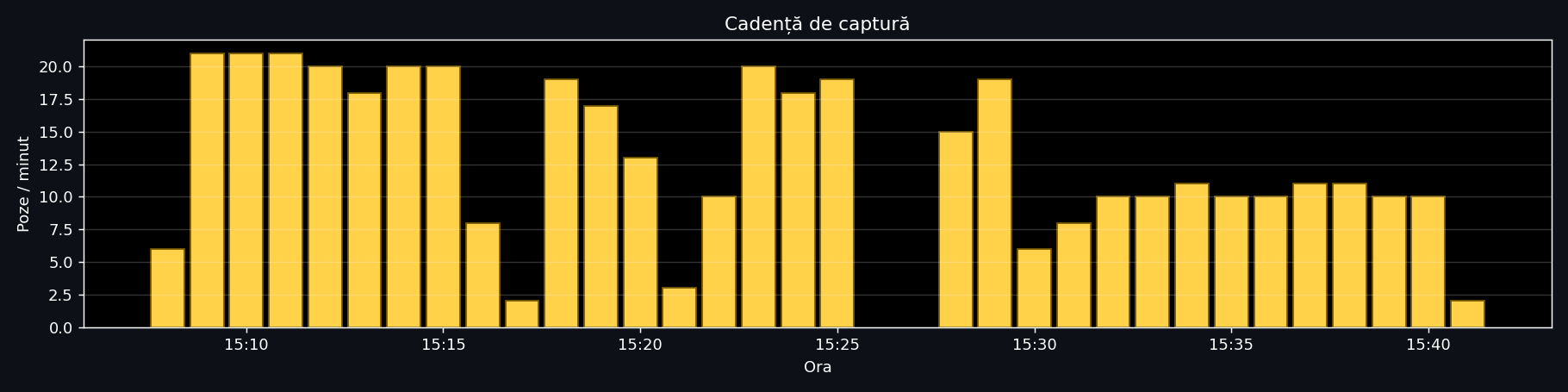
Capture rate
12.9 photos/min
Path length
4.99 km
Area covered
4.11 ha · 222×185 m
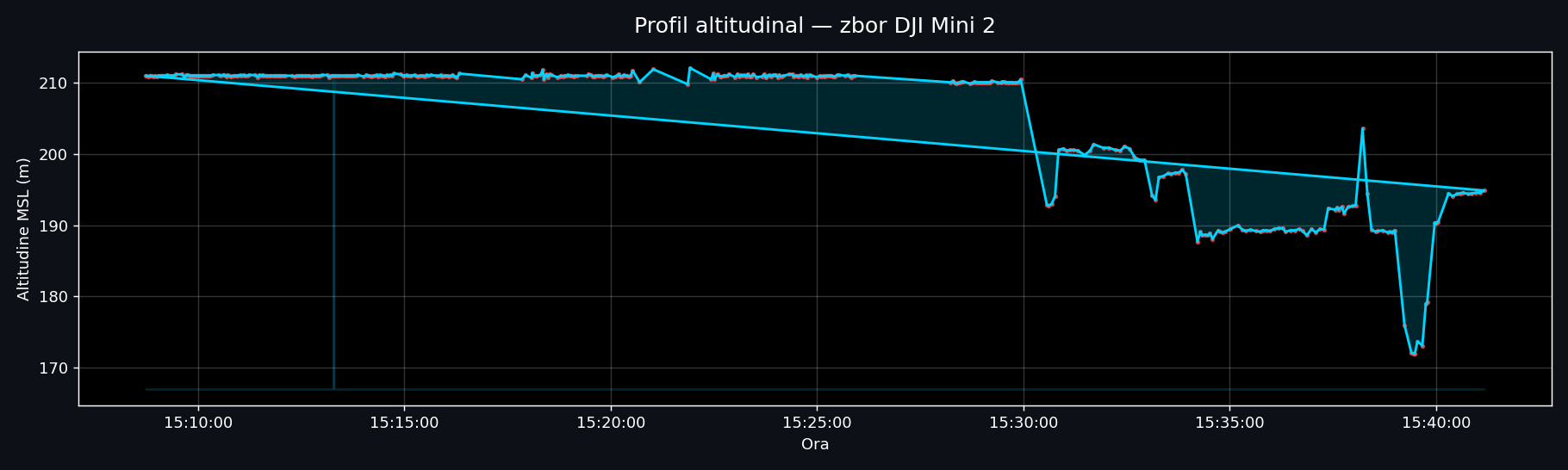
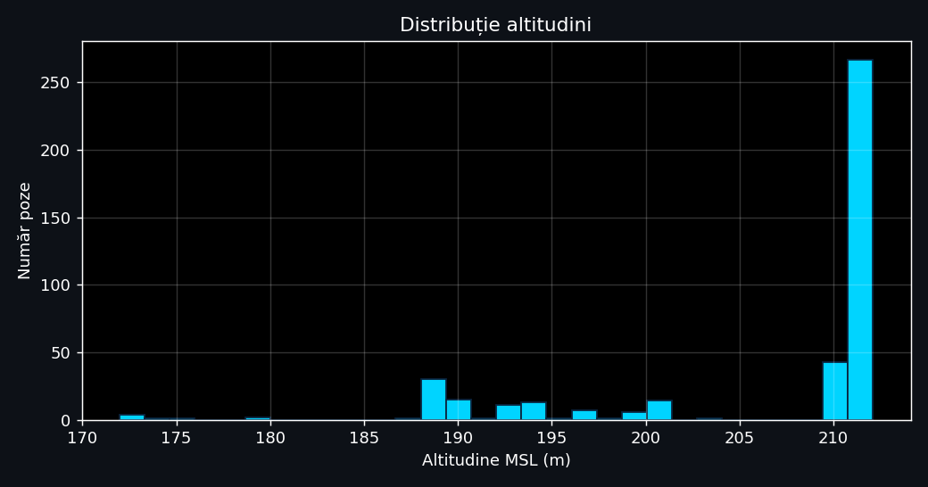
Altitude MSL
206.0 m (max 212.1)
Altitude AGL ≈
126 m (max 132)
Location
Address & institution
| Institution | USAMV București — FIFIM |
| Faculty | Land Reclamation and Environmental Engineering |
| Country | Romania |
| City | Bucharest · District 1 |
| Address | 59 Bd. Mărăști, 011464 |
| Coord. centru (WGS84) | 44.470277, 26.067932 |
| Coord. SW | 44.469492, 26.066570 |
| Coord. NE | 44.471157, 26.069370 |
| Official CRS | Stereo 70 (EPSG:3844) |
Equipment & capture
| Manufacturer | DJI�������������������������� |
| Sensor model | FC7303����������������������� DJI Mini 2 |
| Image resolution | 4000×3000 px (12 MP) |
| Focal length | 4.49 mm (equiv. ≈24 mm) |
| Aperture | f/2.8 |
| ISO | 100 |
| Exposure time | 1/60 s |
| Format | JPEG cu EXIF + GPS |
Interactive flight map
Animated blue trail = drone path · Red dots = each photo position · Green = start · Red = end · Toggle between satellite (Esri) and OpenStreetMap from the top-right.
Altitude profile & capture cadence
Highlights selection — 12 frames from the flight
Full gallery — all 419 photos
Click for full-resolution view · Arrow keys ←/→ for navigation · Esc to close.
Orthophoto — WebODM result LIVE · 2D MAP
Photogrammetric processing in WebODM of the 419 UAV photos → georeferenced orthophoto (Stereo 70). Interactive browser visualization on drone.ugaerial.ro.
Open in new tab →
Pan / zoom · measurements · mobile support · CRS Stereo 70 (EPSG:3844)
LiDAR point cloud — Potree viewer LIVE · 3D POINT CLOUD
LiDAR point cloud captured at USAMV FIFIM campus — accessible to anyone in browser, with measurement tools, sections, and georeferenced PNG+PGW export.
Open in new tab →
Rotate / zoom 3D · measurements · sections · PNG+PGW export · Solid Surface mode